My Tasmania: A Personal View
SITE UNDER CONSTRUCTION. INFORMATION AND PHOTOGRAPHS ARE BEING ADDED PROGRESSIVELY
Last additions: 17 April 2011
Tasmania brief facts
These notes are based on a number of sources, including the Australian Bureau of Statistics (http://www.abs.gov.au) publications: "Tasmanian Year Book" and the pamphlet "2000 Tasmania at a Glance".
Tasmania is the smallest of the six States of Australia. It comprises a group of islands lying 250 km. due south of Victoria on the southeastern corner of the continent (MAP). The total land mass of Tasmania is 68,119 sq.km., the main island measuring at its maxima 296 km from north to south, and 315 km west to east. It extends from 40°38'S to 43°39'S latitude, and from 144°36'E to 148°23'E longitude (MAP).
The Australian Pilot v.II describes Tasmania as "probably the most thoroughly mountainous island on the globe", but this relates to the frequency rather than the height of the mountains. Like the rest of Australia, it is an ancient, weathered land and few peaks exceed 1,500m. Rainfall is relatively high in Australian terms, but varies greatly regionally from lows of 550mm (22inches) annually on the northeast coast to 1,750mm (70inches) in the Northwest Highlands. There are many rivers and lakes, and since 1911 hydroelectricity has been the State's main power provider.
The climate is mild, in major settlement areas seldom dropping much below 0°C (32°F) on winter nights and seldom exceeding 30°C (86°F) on midsummer days. However, being mountainous, having a relatively small landmass, and with only the Southern Ocean between it and Antarctica, the weather can be very changeable, within hours and within seasons. There are frequently Indian summers in winter, and white Christmases (mid-summer) on occasion even in Hobart City. The most consistently sunny and warm weather is generally in February, the most equable season is autumn (April/May), and August is traditionally the "snow" month, though in the past decade snow in lowlying areas has been far less frequent or heavy than in the preceding decade. There are winter ski-fields in the northeast and south-centre.
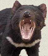
With 0.9% of Australia's landmass, Tasmania has 2.4% of Australia's population ( 476,481 in the 2006 Census). Consistent with that population relativity, Tasmania produces 2.3% of the country's agricultural value, and 2.4% of the foreign trade, but it accounts for only 0.4% of Australian imports. Principal economic production is in agriculture, forestry, and mining, but the island has also earned an international reputation for the quality of its art, craft, and design, with many artists settling here from other States and overseas.
One Brief History of Tasmania
1. The First Tasmanians, and European Discoveries and Invasion
The Pictures
3. The Tasman Peninsula, South-East Coast
LINKS: Discover Tasmania | The Companion to Tasmanian History | Tasmanian History Links | Tasmanian Aboriginal Heritage | Tasmanian Aboriginal Historical Services | Tasmanian Aboriginal Stories | Tasmanian Museum & Art Gallery